
Looking Up Your Arkansas Neighbors
In Arkansas, the block around one address is best read as a set of parcel and community records, each with its own boundary. County GIS can show nearby lots; an assessor can connect a selected parcel to tax ownership; a circuit clerk can supply filed deeds or plats; and local association layers can provide public contacts. Historical directories can place a name at a past address. The result is a path to understand the block, not a public roll of every person who lives there.
| Arkansas source | What it shows about a block | Access and limit |
|---|---|---|
| County GIS parcel viewer | Adjacent parcels, parcel IDs, roads, districts and a chosen buffer | Benton viewer online; other county tools vary. Map lines are not surveys. |
| Assessor and CAMP | Owner and parcel fields for selected lots, with address and source dates | County portal or counter; owner and mailing address do not prove presence. |
| Circuit Clerk/Recorder | Recorded deeds, plats, easements and parties for a parcel | County index or book; Washington's online land index covers 1834-1991. |
| VoterView and SOS file | Limited registration lookup or controlled voter-file fields | VoterView is not a block roster; full files require an SOS request. |
| City association layer | Boundary, public contact and meeting information in Little Rock | City map and contact page; not a member list. |
| Criss-cross directory | Historical address-to-name entries for a printed year | Library or digitized holdings; not a current household record. |
A parcel match establishes a relationship between a land record and a mapped lot. It does not establish who is present, whether an owner lives there, or who else shares the address. A tax mailing address may point elsewhere, and a nearby parcel may be vacant, held by an entity or separated by a road or easement. Keep the block boundary and source date visible when describing the results.
For a parcel record, start with the county GIS or assessor portal; if the result is missing, call or visit that county's assessor or mapping office. A deed, plat or easement comes from the county Circuit Clerk/Recorder, whose index and in-person books vary by county. Washington County's Circuit Clerk and Archives show the local handoff from recorded land material to historical indexes. Ask the clerk by phone, at its counter, or through its written or mail-request route; copying terms depend on the custodian. A maintained public record may also be requested under Arkansas FOIA; no office has to create a new statewide parcel or people list.
Map Arkansas Neighbors with Benton's Buffer Tools
Benton County's interactive parcel viewer is the clearest inspected example of finding adjacent parcels. Start by opening a parcel map and finding the target address with Graphical search or map browsing. Click or select the target parcel, then inspect the parcel shapes that share its visible edge. That direct map browse gives a simple block view; a buffer creates a repeatable area when the search needs a wider ring than one street segment.
For a fixed ring, choose Spatial search, enter a buffer distance and unit, apply the buffer, and use “Select Features In” with either “Intersect By” or “Contain By.” The Results panel can print the selection, export it as CSV or clear results. Save the distance, unit, selection predicate and date with the parcel IDs, since those choices determine which lots appear. A radius may cross a road or reach outside a familiar block, so describe the selection instead of calling every result a next-door property.
Use the export as a checklist for the assessor. The map supplies parcel IDs and geometry; Benton County's property-information search supplies the county tax-owner details that its records expose. Benton is one county example, and other Arkansas counties may use different GIS vendors, layers or public access. If a county map does not offer a buffer, browse one parcel at a time or ask the county GIS/assessor office how it handles adjacent parcels.
Note: Intersect By and Contain By are separate selection choices, so record which one shaped the exported parcel set.
Arkansas CAMP Snapshots around a Block
The Arkansas GIS Office CAMP parcel service can help when a county map is hard to reach, but it draws from county CAMA snapshots and does not have one statewide update schedule. Useful fields include OwnerName, AdrLabel, AdrCity, AdrZip5, ParcelId, ParcelLgl, subdivision, Section/Township/Range, value fields and PubDate/CAMADate. These let a researcher align a map feature with a county parcel record and note how old the source may be.
CAMP is an informational cadastre, not a legal survey. A visible line should not settle whether two properties touch, and a recorded owner should not be described as everyone who lives there. County participation, completeness and source dates vary. For an uncertain parcel, take the CAMP identifier or legal description to the county assessor or GIS office and ask which local record is current. If a county map is unavailable, ask the assessor or GIS office by phone or at its counter; for a maintained public record not available online, a specific Arkansas FOIA request can be made in person, by phone, mail, fax, email or electronic submission. The Arkansas FOIA handbook summarizes the request process.
Mapping Arkansas Neighbors with Benton's Spatial Tools
Use a single address to make a documented parcel set, then check each selected lot against its county assessment record. Benton County offers the most detailed inspected workflow in Arkansas; its buffer and spatial controls show how a block search can be repeated and checked.
- Locate the address in the Benton parcel viewer by text search or map browse, and select the parcel that matches the street address.
- Choose adjacent lots by visible shared edges, or set a buffer distance and unit for a wider area; note if roads or large lots cross the ring.
- Use the Results panel to print or export CSV, saving the parcel IDs and the Intersect By or Contain By choice used to make the set.
- Open each selected ID in Benton's Property Information search and compare its owner, mailing address, situs and legal description.
A homestead indicator and matching mailing/situs address can provide context, but neither proves who is present. If you need a full named-street record chain, use the Arkansas Street Directory walkthrough, which covers address-to-assessor-to-deed research. Keep this page's result focused on the surrounding parcels and public community contacts.
Little Rock's Official Association Map and Contacts
Little Rock is the inspected Arkansas example of a city layer that reveals community contacts without publishing a membership list. The official map and GIS expose association name and status, ward, contact name and address, phone, email, website, meeting information and officer fields. The city reports more than 190 neighborhood associations, property associations and community development corporations, so use the map to identify a group and its public contact route rather than infer who belongs to it.
| Community source | Public information | Access and boundary |
|---|---|---|
| Little Rock association GIS | Association name/status, ward, contact details, meeting and officer fields | Official GIS layer; it describes civic contacts, not members. |
| Little Rock association page | Interactive map, meeting contacts and links to neighborhood resources | City page and contact list; do not treat an address as proof of membership. |
| Fayetteville neighborhood groups | Voluntary groups may include residents, businesses, churches and schools | City guidance distinguishes those groups from HOA/POA structures; no member directory is promised. |
The GIS layer is useful when parcel geography needs a civic context. Its officer and contact attributes answer who to ask about public meetings or group information; they do not supply private membership records.
Little Rock's official GIS provides the association name and contact attributes shown here; open the Little Rock neighborhood association layer for its current fields.
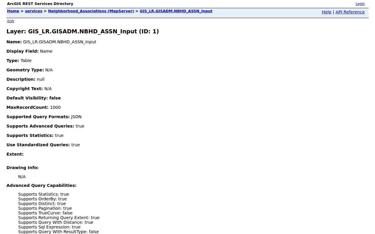
This public contact layer can orient a reader to a civic group and its meeting information, while keeping the distinction between a contact and a member clear.
The city association page links its interactive map and meeting contacts and describes resources for neighborhood groups. Review the Little Rock neighborhood associations page for current contact routes.
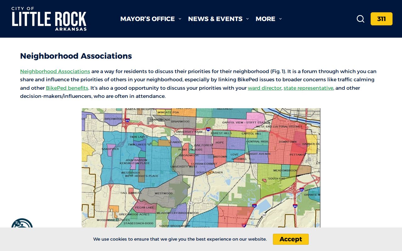
The page adds a public route to city resources; it still does not turn the map into a list of households on a block.
Note: The city's count of more than 190 associations, POAs and CDCs describes community groups, not the households or members on a block.
Fayetteville's Voluntary Groups and HOA or POA Structures
Fayetteville's official explanation of neighborhood associations separates voluntary groups from HOA and POA structures. A voluntary group may bring together nearby residents, businesses, churches and schools, while the city's guidance does not promise a member directory. For an Arkansas address in Fayetteville, use a published group contact or city resource page to ask about public meetings and activities; do not infer that everyone on nearby parcels belongs to that group.
The difference matters because parcel boundaries and association boundaries do not necessarily line up. A city map can describe geography, and a public contact can identify where to ask a civic question, but neither establishes membership. For a place outside an incorporated city, county GIS, planning maps and civic pages may help locate a public organization. If there is no published boundary or contact, use parcel, ward and precinct only as geographic context.
Across Arkansas, congregations, block watches and civic-club rosters may be private or held in local archives. No statewide public block-roster source was located. Libraries, city departments and local organizations can explain their own public access rules, but one county's map should not be presented as an all-state directory.
How VoterView Represents Arkansas Neighbors at Block Scale
Arkansas Secretary of State VoterView is a public lookup for registration status, polling place and sample ballot. It is not designed to display everyone on a street. The Secretary of State's data request form handles broader products, including VR registration data, VH federal-election history and combined VRVH files. A request requires requester contact details and product choices, with map and district fields for some products; the current inspected form reports $2.50 per file and Dropbox delivery.
The VR description includes voter ID, county, name, residential and/or mailing address, phone, date of birth, precinct, district, party if applicable and last-voted date. The public lookup does not necessarily display those fields. VH is linked by voter ID and contains federal-election history from 2008 to the present without names. Do not confuse participation history with a vote choice, and do not republish a controlled file as a casual block list.
For an individual public-status question, use VoterView or call SOS voter services at 1-800-247-3312 or voterservices@sos.arkansas.gov. The Secretary of State's voter data request form describes file and map requests. County election offices may also handle in-person questions, but contacts vary by county. A protected or missing address, an inactive record, a recent move or a different address form can explain a non-match; it does not prove a person is absent from Arkansas.
Note: VoterView's public display is narrower than the controlled data products available through an SOS request.
Historic Arkansas Neighbors in Criss-Cross Directories
Historical reverse directories let a researcher start with an address and find the name printed for that place in a particular year. The Library of Congress guide includes Arkansas criss-cross holdings and Northwest Arkansas runs for 1937 and 1970-1993. A city directory works from a name to a listed address, so compare the two carefully rather than treating them as the same source. The listed person may be a householder or a business entry, and the volume is only evidence for its publication period.
The Library of Congress criss-cross guide and local library catalogs identify print, microfilm and digitized holdings. Fayetteville Public Library's Grace Keith collection includes county books, maps, newspapers, directories, microfilm scanners and genealogy research help. The Washington County Archives also holds 1919 voter records and a 1908 plat book, which can add local context to older block research.
Keep the printed address, year, city abbreviation and volume/page together. Street suffixes, directional letters, block layouts and postal labels may differ from current usage. For a modern block, export the selected parcel IDs and verify them in county assessment records; for a historic block, retain the exact wording from the directory and compare it with maps or deeds. These are separate timelines, not a single continuous resident list.
Note: A criss-cross entry records what a directory printed for its year; it does not show who occupies that address now.
Official Block Records and Commercial Neighbor Tools
Both types of source may appear when someone searches for information about neighbors, but they answer different questions. A county map or assessor card traces a parcel and names the custodian; a commercial compilation may combine public records with purchased data. Use the original source when the point is to understand a block or verify a public fact.
| Source category | Strength for block research | Limit to keep in view |
|---|---|---|
| Official county GIS and assessor | Parcel geometry, tax-owner fields and source dates from the responsible county | Does not list everyone present at an address; fields and currency vary. |
| City association contact layer | Public contact, meeting and boundary information for civic groups | Not a private member roster or a block census. |
| Commercial record compilation | May join public and purchased data into a broad search result | Can merge people with similar names or retain stale address links; confirm with the custodian. |
Privacy Limits on Looking Up Arkansas Neighbors
Public block information has clear gaps. Parcel records do not list every person at an address, utility customers and delivery recipients are not public rosters, and private association members are not identified by the Little Rock map. Arkansas has no statewide Safe at Home program identified in the official sources reviewed, but court seals, protected voters, adoption confidentiality, juvenile and expunged records, and agency-specific redactions still apply.
When a record is wrong, contact the office that keeps it: the assessor for a tax-card error, the election office or Secretary of State for voter data, and the circuit clerk for a recorded instrument. A commercial service may combine public and purchased data and can attach an old address to the wrong person; a service's copy does not correct the county record. Use the original custodian and retain the source date.
Lawful use. Use Arkansas parcel and community records for personal history or civic understanding. Public access is not permission to track, threaten or harass a person; the state's anti-stalking law addresses repeated conduct.