
Starting an Arkansas Street Directory Search with an Address
An address is a joining point for records, not a person. In Arkansas, start with the county that keeps the parcel record, then follow the parcel number or legal description to related sources. This helps separate the tax owner from an occupant and a current street label from the legal description used in a deed. The steps below work as a research path; the available portal and years differ by county.
- Write down the complete street address and identify its Arkansas county; a city or postal label alone may not identify the record keeper.
- Search the county assessor by address or parcel number, and note the owner, situs address, mailing address, legal description and the date on the record.
- Open the county GIS viewer to see the parcel shape and nearby lots; use the map as a navigation aid, not a legal survey.
- Use the parcel and owner as keys in the circuit clerk's deed index. In Washington County, search grantor and grantee entries, then follow the seller's name backward.
- For a historical household, compare the street address with directory years and a reverse directory. A directory can place a listed name at an address in its publication year, not confirm a present-day occupant.
Arkansas VoterView can answer its public registration, polling-place and sample-ballot questions, but it is not a public street roster. If the task becomes a history of a block rather than a named street, the Arkansas neighbors page explains the adjacent-parcel and civic-contact layer.
Benton's Arkansas Street Directory Search Fields
Benton County provides a concrete example of an address-keyed county search, not a portal for all Arkansas parcels. Its Property Information screen accepts a name, address or parcel ID. A successful match can lead to assessor details such as the owner, physical location, mailing address, legal description, valuation, assessment history and homestead information. The assessor's real-estate office is the custodian when an online result is missing or needs clarification.
The screenshot below shows the county's property-information search controls. Use the linked Benton County Property Information search for the current form and county record.
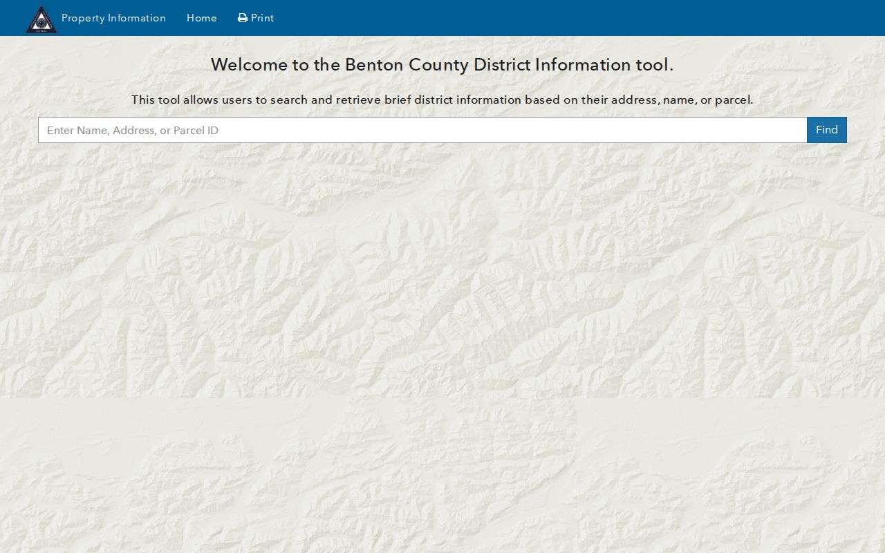
The screen offers a short route into Benton parcel records; it does not establish who currently occupies a parcel or whether another county uses the same fields.
| Search control | What to enter or select | Use in an address search |
|---|---|---|
| Search prompt | Name, Address, or Parcel ID | Start with the full situs address when known; a parcel ID avoids street-spelling variation. |
| Find | Submit the chosen name, address or parcel value | Open the matching county record and preserve its parcel identifier. |
| Assessor detail | Owner, legal description, situs and mailing details where provided | Compare the physical parcel location with the address used for tax mail. |
Benton assessor real-estate service is county-specific. The Benton County assessor lists its real-estate office at 479-271-1037; use its counter or phone when the online card needs clarification. For a different Arkansas county, use its own assessor portal because search fields, map layers and update timing vary.
Map Adjacent Arkansas Parcels around a Street Address
Benton County's parcel viewer adds map selection to the text search. Its Search tab offers Text, Graphical and Spatial modes, followed by a search-layer choice and Find action. A map click can help when a street number contains punctuation, a directional prefix, or an older form that the text box does not match. Once the target parcel is clear, the viewer can show the lots along the same stretch of road and the parcel edges that connect the map to assessor records.
For a street-level pass, choose the parcel layer and either search the address as text or select it on the map. Then inspect surrounding parcels and use a buffer when a fixed radius is more useful than a street segment. Buffer distance and unit are user controls; Apply Buffer and Clear apply or reset the selection. Results can be printed, exported to CSV or cleared, which gives the researcher a parcel list to verify against the assessor instead of treating the map as a resident list.
Spatial selection offers “Select Features In” with “Intersect By” or “Contain By.” The selection rule affects which parcel shapes enter the result, especially near a road or buffer edge. Record the mode, distance and predicate with the exported file so another reader can repeat the same search. A parcel map describes geography; it does not show private household membership or settle a boundary dispute.
Arkansas also publishes the CAMP parcel service through the Arkansas GIS Office. County participation and data dates vary, so a statewide layer is a fallback and cross-check, not a replacement for the county assessor's current card.
Terms. A parcel is the mapped tax unit; a situs address identifies its physical location; a plat depicts lots or subdivisions; and a criss-cross directory is a historical address-to-name source.
Note: A buffer can include parcels across a road or outside the block a reader has in mind, so keep the selection rule with the result.
Arkansas Street Directory Records You Can Compare
Arkansas has no uniform set of address records across its 75 counties. The county assessor and GIS are the first route from a street to a parcel; a circuit clerk's index supplies filed instruments; city permit systems and 911 offices explain some address changes; voter tools and historical directories answer narrower questions. The table separates what each source can support from what it cannot prove.
| Record set | Arkansas keeper or example | Street evidence | Access and boundary |
|---|---|---|---|
| Assessor card | County assessor; Benton and Washington examples | Tax owner, parcel, situs and mailing details, value and legal description | County portal or assessor counter; field sets and update dates differ. |
| GIS parcel layer | County GIS or Arkansas CAMP | Parcel geometry, nearby lots, address labels and map context | Online map; informational cadastre, not a legal survey. |
| Recorded documents | County Circuit Clerk/Recorder of Deeds | Grantor, grantee, instrument type, book/page, legal description and filed transfer | County index and clerk; Washington online range is 1834-1991. |
| Permits and planning | Municipal portal or department | Applicant, project, address or parcel when exposed by that city | Little Rock has an online lookup; statewide coverage dates were not verified. |
| Address assignment | Washington County 911 addressing example | Assigned address tied to parcel, subdivision and lot information | Application and county office; does not guarantee utility service. |
| Voter lookup | Arkansas Secretary of State | Public registration status, polling place and sample ballot | VoterView is not a street roster; broader files use a controlled request. |
| Reverse directory | Library of Congress and local libraries | Historical address-to-name entry for a listed year | Print, microfilm or digitized holdings; it is not current occupancy evidence. |
ParcelId and legal description are the strongest bridges between map, assessor and deed. A street name can change or be formatted differently, while a recorded instrument may use a subdivision lot or section-township-range. Keep situs, tax-mailing and postal addresses in separate fields. A homestead flag may support an owner-occupancy inference, but it can be stale and does not identify all people at the address.
Reading CAMP Fields in the Arkansas Street Directory
The Arkansas GIS Office's CAMP parcel layer includes records drawn from county CAMA data. Its field names show why a result should be saved with its provenance rather than copied as an undated fact. Address pieces are assembled into AdrLabel, while ParcelId and ParcelLgl can connect the parcel to local assessment and deed records. CAMADate, PubDate, SourceDate and provider fields describe the snapshot's source or timing; there is no universal county update date.
| CAMP field or group | What it records | How to use it carefully |
|---|---|---|
| ParcelId, CountyId/CountyFips, CAMA Key, ParcelType | Parcel identity and county/source key | Carry the ID to the county assessor or recorder. |
| AdrNum, street pieces, AdrCity, AdrZip5, AdrLabel | Address components and assembled label | Try number, direction and suffix variants if a text search misses. |
| OwnerName | Name associated with the assessment parcel | May identify an entity, trust or estate; does not establish current presence. |
| ParcelLgl, Subdivision, Section/Township/Range, STR, NBHD | Legal and geographic placement | Use these fields when a street label changed or fails to match. |
| AssessValue, ImpValue, LandValue, TotalValue | Assessment values in the source record | Assessment figures are not a market appraisal or occupancy record. |
| SourceRef, SourceDate, CAMAProv, DataProv, CAMADate, PubDate | Data origin and date context | Compare dates before treating two records as inconsistent. |
| Shape, GlobalID | Map geometry and service identifier | Use for GIS context; a mapped edge is not a boundary survey. |
The inspected statewide layer did not expose a deed-image link and does not promise a separate current mailing address field. Use the county assessor's detail to compare tax-mailing and situs addresses, then follow the parcel to the local recorder. The assessor's dated snapshot is evidence about the source at that time, not a live census of Arkansas residents.
Note: A CAMP publication date describes the source snapshot; it does not promise that every Arkansas county refreshed its parcel data at the same time.
Follow Washington County's Deed Chain Behind a Street
The Washington County Chronicle is a county land index, not an Arkansas statewide deed-image portal. Its searchable range is 1834 through 1991. The search offers a document-type dropdown, sort order, full search, book, page start and end, a Grantor/Grantee choice, last name, first name, Search and Clear. Search the current owner's name as grantee to find the purchase, then carry the seller's name backward as grantee. Repeat with spelling, initials and entity variants when needed.
A returned index entry gives a document reference and book/page clues; the index should not be mistaken for the full legal instrument. The Washington County Circuit Clerk handles recorded documents at 280 N College Suite 302 in Fayetteville and lists 479-444-1538 for contact, while the county Archives holds original and handwritten indexes. The online cutoff matters: current coverage after 1991 was not confirmed in the inspected official material. For later records, use the clerk's current books or request route; for older or unclear material, ask the Archives to locate the relevant record.
Washington's recorder page lists deeds, mortgages, releases, easements, plats, liens and other filings. A release can close a mortgage without changing ownership, while a plat or easement may explain a relationship between adjacent lots. Compare the deed's legal description and prior-instrument number with the assessor's parcel details. A missing street string does not prove that a transfer is absent if the record is indexed under a grantor, grantee, lot or legal description.
A Washington index result is an entry in a convenience index, not an inspected instrument image. The visible inventory is narrow and useful for carrying a search to the next record:
| Index result field | What to capture |
|---|---|
| Document type and search/sort text | Record category and the query used to find it. |
| Grantor or Grantee; party names | Party direction, last name and first name as indexed. |
| Book and page range | Book, page start and end for retrieval from the custodian. |
| Document reference | The returned index reference; the inspected crawl did not expose a reliable named result or image. |
The search fallback is local: online index first, then the Circuit Clerk's counter or phone, a written or mail request, and the county Archives for its historical material. Washington County lists its Archives at 4 S College Ave in Fayetteville, 479-444-1543, with research on Wednesdays from 9 to 3 and a noon-to-1 lunch closure. The county's 911 address application is a separate route when a parcel needs address-assignment context. Arkansas citizens may inspect maintained public records during regular business hours; inspection is normally free, while the custodian may charge actual reproduction and mailing costs and may collect projected costs over $25 in advance. Requests may be made in person, by phone, mail, fax, email or electronic submission, subject to exemptions; a custodian need not create a new compilation. The Arkansas FOIA handbook explains the process.
Note: Washington's 1834-1991 online index is one county example; other Arkansas counties have different online coverage and access routes.
Arkansas Address Assignment and Street Numbers
A current street label may not match an old record even when the parcel is the same. Arkansas has no single statewide street-numbering authority; county 911 offices, municipal planning teams, assessors and GIS offices control different pieces. Benton and Washington County examples should therefore stay attached to their county names rather than stand in for all 75 counties.
Washington County's 911 address application ties an assignment to owner, parcel number, reason, mailing address, applicant and phone, use category, subdivision and lot, email or comments, plus aerial or survey materials and neighbor information. The county says an address is assigned within two weeks, and warns that an assigned address does not guarantee utility service. The form can help a researcher understand how a rural or suburban address relates to its parcel and plat; it is an address-assignment process, not a public roster of people.
Old Arkansas Streets on Little Rock Plats and Permits
In Little Rock, the original city plat filed in 1822 provides an early map layer for old blocks and street names. The digitized Little Rock plat, annexation maps and city/county suffixes add jurisdiction context. For a historic mismatch, compare the current parcel's legal description, subdivision lot, directional prefix and suffix, city label and adjacent streets with the old map rather than relying on one modern street string. The plat is a geography clue, not a resident list.
Little Rock's permit lookup lists Permit, Planning, Project, Sign, Trade License and Use Permit modes. Address or parcel searches are available for the permit categories inspected; trade-license search accepts a license number or applicant. The city portal's complete historical coverage was not verified, and an applicant may be a contractor, architect or prior owner. Use the city clerk or relevant department for a maintained record that is not online, then ask the county assessor or recorder to confirm the property facts.
Historical Arkansas Street Directory Entries Need a Date
A street-by-street search can turn backward when the modern parcel key stops. The Library of Congress criss-cross guide lists Arkansas reverse-directory holdings, including Northwest Arkansas runs in 1937 and 1970-1993; local libraries and other collections may hold print or microfilm copies. These books start from an address and return the name printed for that address in that year. A city directory works in the other direction, from a person's name to a listed address, and its entries need their own year and location context.
Fayetteville Public Library's Grace Keith collection offers county books, maps, newspapers, directories, microfilm scanners and research help. The Arkansas State Archives and county Archives can also hold older tax, land, voter or court material. Access may mean an in-person visit, a library catalog or microfilm search, an email research question, or a copy request; a source may not be digitized. The library shelf and the directory collections are described in more detail on the Arkansas city directory page.
When comparing a historic listing, retain the exact printed street form, city abbreviation, year and volume/page. Polk entries may use LR or NLR, abbreviate road types or separate numbered streets in ways that do not resemble current labels. A business listing can also occupy a street address. An old directory entry shows what the volume recorded, not a present resident or a complete household.
Note: A directory's publication year and a deed's recording date describe different events, so they may not change at the same time.
What the Arkansas Street Directory Cannot Establish
County property records usually name an owner or entity attached to a parcel. They do not provide a complete list of occupants, people who receive mail there, or everyone in a household. A tax mailing address may be a different place from the property, and a permit applicant may be a contractor or former owner. Arkansas VoterView confirms only the public status, polling-place and sample-ballot information it displays. The Secretary of State's broader voter-file products are controlled requests, not a casual block roster; protected addresses and statutory limits still apply.
Driver and vehicle information is restricted under the federal Driver's Privacy Protection Act. Utility customer lists and private association membership records are not public address directories. Arkansas has no statewide Safe at Home program identified in the official research, but that does not remove court seals, protected-voter handling, adoption confidentiality or other source-specific redactions.
Lawful use. Use Arkansas street and parcel records for lawful personal research, family history or civic questions. Public availability does not give anyone permission to stalk, threaten or harass another person.